Iceland Volcano: Eruptive Activity Is Relatively Stable -- Iceland Met Office
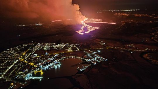 The eruption seen from the Coast Guard's surveillance flight with Grindavík in the foreground. The picture was taken at 00:15, March 17. (Photo: Public Safety/Björn Oddsson)
Updated Hazard Map
Updated 18 March at 18:30 UTC
The Icelandic Meteorological Office has updated the hazard assessment to account for the latest data. The new hazard assessment takes effect today, Monday, March 18, and is valid until March 20, unless the situation changes. Zone 3 (the Sundhnúkur crater row), where the volcanic eruption is still ongoing, remains unchanged, with the hazard level remaining very high. The hazard level is assessed to remain high in Zone 1 (Svartsengi) due to gas emissions and lava flows. The same applies to Zone 4 (Grindavík), where the danger due to sinkholes above fissures, fault movements, lava flows, and gas emissions is considered high. Zone 5 has been downgraded to considerable risk (orange) and Zone 7 is now downgraded to some risk.
The reason for assessing the danger as greater in Zone 1 than in Zone 5 is the closer distance to the active end of the eruptive fissure. The weather forecast and gas dispersion forecast for the next few days will affect the assessment of gas pollution and ash in the hazard assessment.
 (Click map to enlarge)
Updated 18. March at 16:50 UTC
- The volcanic eruption's activity has been relatively stable since late yesterday.
- There is a very slow movement of the lava flow towards the road Suðurstrandarvegur.
- This morning, the lava flow was approximately 330 meters from the road. The margin has not advanced significantly since yesterday evening.
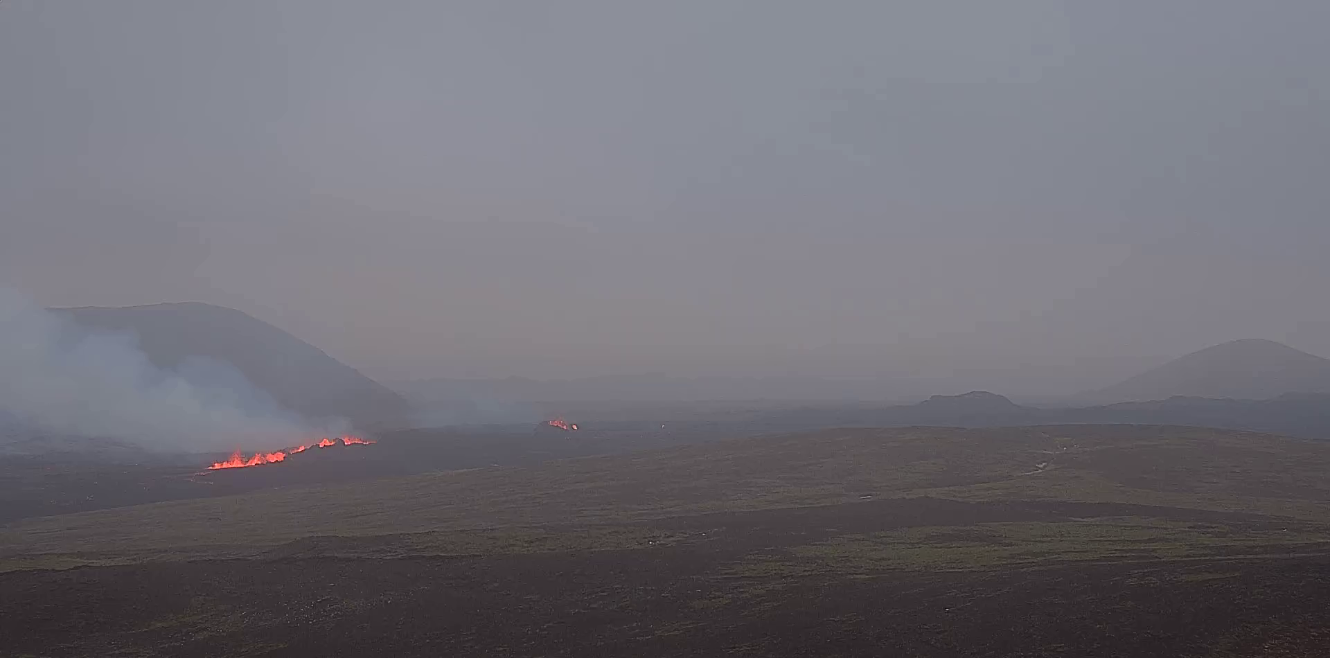
Eruptive activity has been relatively stable since yesterday afternoon. The eruption is focused at two locations along the eruptive fissure, but the northernmost craters that were active yesterday are not active now. The most active areas are near the southern end of the eruptive fissure that opened on Saturday evening, with lava flowing from these locations southward towards the road Suðurstrandarvegur. This morning, the lava flow was approximately 330 meters from the road, with minor movement of the margin since yesterday evening. Observations of the area yesterday evening indicate that there is not significant activity or movement of the lava flow that crossed the road Grindavíkurvegur a few hours after the eruption started.
The extent of the new lava is estimated to be 5.85 square kilometers, based on satellite imagery acquired at 14:56 yesterday, March 17. See the accompanying map. This area estimation, based on satellite data, contains greater uncertainty than calculations based on aerial photographs. If weather conditions allow, an aerial survey of the eruption site will be conducted later today, providing more accurate calculations of the area and volume of lava.
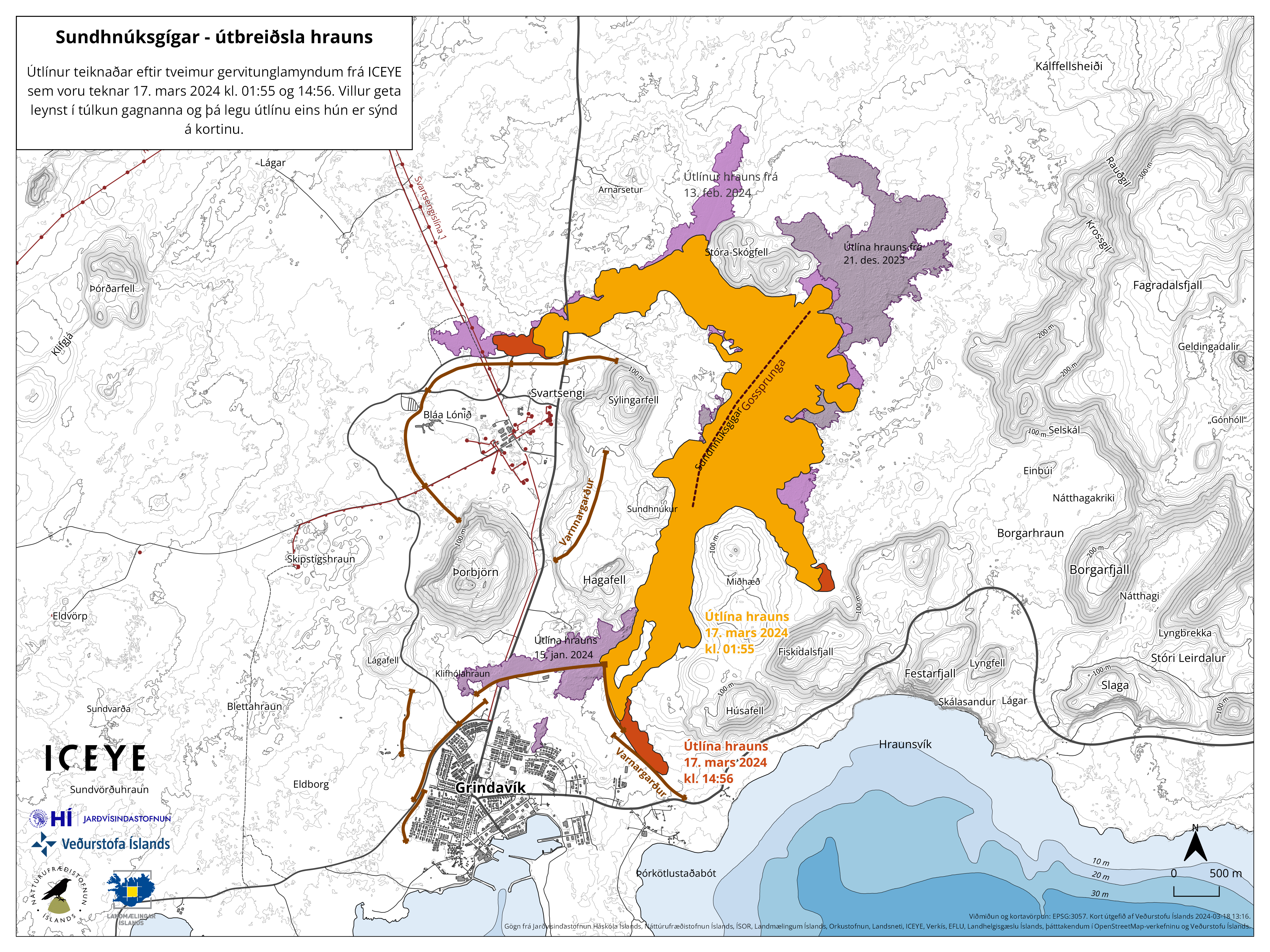 The outlines of the lava flow are drawn from satellite images from Iceye. The first image was taken on March 17 at 01:55 (orange color), which is about five and a half hours after the eruption began. The second image was taken at 14:56 on March 17, showing the outlines of the lava, as it was then, shown in red. Purple colors indicate lava flows from previous eruptions.
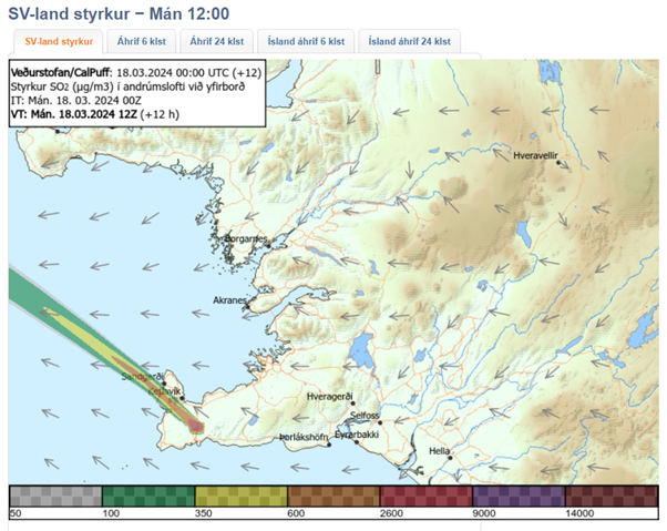 The weather forecast for later today brings wind from the southeast and east with a speed of 8-13 m/s at the eruption site, followed by decreasing winds from the south and southwest. Gas emissions will therefore drift northwest and west, with a shift to the north later today. Significant uncertainty exists in the strength of gas emissions. Wind from the southwest with a speed of 10-18 m/s is expected tomorrow morning, so the gas emissions will then travel to the northeast. It is unlikely that gas emissions will reach the Capital Region due to strong winds. The gas dispersion forecast can be monitored here.
There is minor seismic activity near the eruption site and throughout the Reykjanes Peninsula. Only a handful of small earthquakes have been observed. The risk assessment will be updated later today.
- CreatedMonday, March 18, 2024
- Last modifiedThursday, March 21, 2024
