Disasters

In the last two days, approximately 200-300 earthquakes have been detected around the dike that formed November 10. So far today, around 100 earthquakes, the largest measuring M2.0, have been ...
Read more...
The risk assessment map from the Icelandic Meteorological Office was updated Nov. 22. The map is revised in line with the development of the functionality. The unrest phase is not over, difficult to ...
Read more... The risk assessment map from the Icelandic Meteorological Office was updated Nov. 22. The map is revised in line with the development of the functionality. If there would be an eruption, the most ...
Read more... The risk assessment map from the Icelandic Meteorological Office was updated Nov. 22. The map is revised in line with the development of the functionality. If there would be an eruption, the most ...
Read more...
COSMO-Skymed interferogram spanning 24-hours between 18−19 November at 06:41. The broad uplift signal visible in orange/red around Svartsengi is indicative of a deep inflation (>5 km) taking place. ...
Read more... COSMO-Skymed interferogram spanning 24-hours between 18−19 November at 06:41. The broad uplift signal visible in orange/red around Svartsengi is indicative of a deep inflation (>5 km) taking place. ...
Read more... COSMO-Skymed interferogram spanning 24-hours between 18−19 November at 06:41. The broad uplift signal visible in orange/red around Svartsengi is indicative of a deep inflation (>5 km) taking place. ...
Read more... COSMO-Skymed interferogram spanning 24-hours between 18−19 November at 06:41. The broad uplift signal visible in orange/red around Svartsengi is indicative of a deep inflation (>5 km) taking place. ...
Read more... Around 700 earthquakes have been detected near the magma intrusion since midnight, largest M2.7. Information updated regularly here and on X (Formerly known as Twitter). Iceland Met Office Updated ...
Read more...
A map showing the extent of the subsidence over the magma intrusion in and around Grindavík. A GPS station (GRIC) located near the center of the subsidence has recorded a total subsidence of 25 cm ...
Read more... A map showing the extent of the subsidence over the magma intrusion in and around Grindavík. A GPS station (GRIC) located near the center of the subsidence has recorded a total subsidence of 25 cm ...
Read more...Page 9 of 22

Good morning from the Green Mountains of central Vermont

www.malaymail.com/news/world/2026/01/11/bomb-attac…
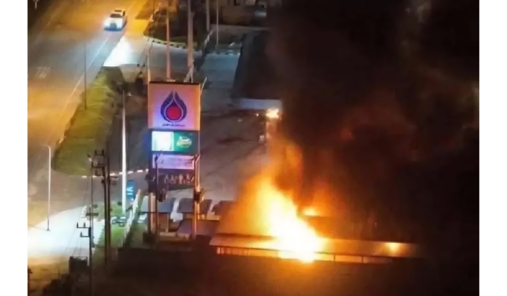
BANGKOK, Jan 11 — A series of late-night bomb attacks targeted 11 PTT petrol stations in Thailand’s southern border provinces of Narathiwat, Pattani and Yala…
www.khaama.com/at-least-eight-refugees-die-37-resc…

At least eight refugees died and 37 were rescued when their boat sank off Badmeli near Izmir, Turkish authorities said on Saturday.
katu.com/news/local/oregon-confirms-first-measles-…

Health officials in Oregon have confirmed the state's first measles cases of 2026, with two people diagnosed in Linn County.