
Iceland Volcano: Ground Uplift Continues At A Steady Rate -- Iceland Met Office
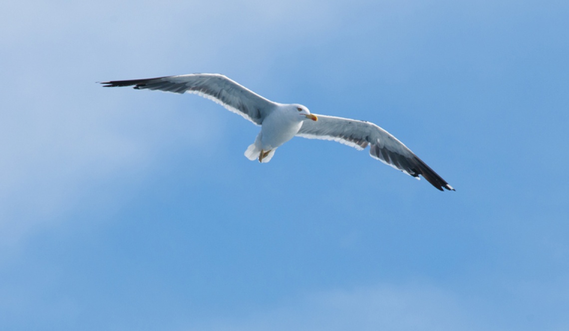
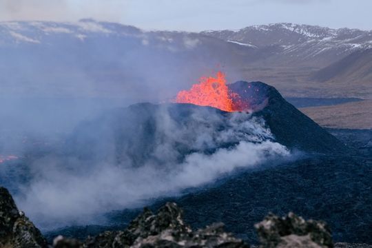 Volcano eruption at Sundhnúkur. Photo taken 10. April 2024 by Jón Bjarni Friðriksson/IMO.
The volume of the lava field has reached 33.2 million cubic meters
Updated 18. April at 16:00 UTC
The lava field now covers 6.15 km2 and the volume is 33.2 ± 0.8 million m3.
Average lava flow from the crater 8-15 April is estimated at 3.2 ± 0.2 m3/s.
Ground uplift in Svartsengi continues at a steady rate.
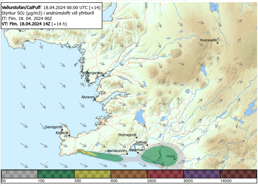
Continued hazard due to gas pollution. People in the area are advised to check the air quality.
The weather forecast for gas distribution today (Thursday) is northwesterly wind, 3-8 m/s, carrying gas emissions to the southeast. Follow the gas dispersion forecast here.
The eruption at the Sundhnúkur crater row continues and one crater just east of Sundhnúkur remains erupting. The lava field continues to build up near the craters. The lava also flows in closed channels about 1 km to the southeast and there are active areas in the lava field north of Hagafell.
On Monday 15 April, scientists from the Icelandic Institute of Natural History (IINH) and the National Land Survey of Iceland (NLSI) carried out a surveillance flight over the eruptive area to acquire images for lava mapping by photogrammetry. The results from the surveillance flight show that the area of the lava field on 15 April measured 6.15 km2 and the volume 33.2 ± 0.8 million m3. The lava flow field and the thickness of it is shown on the map below.
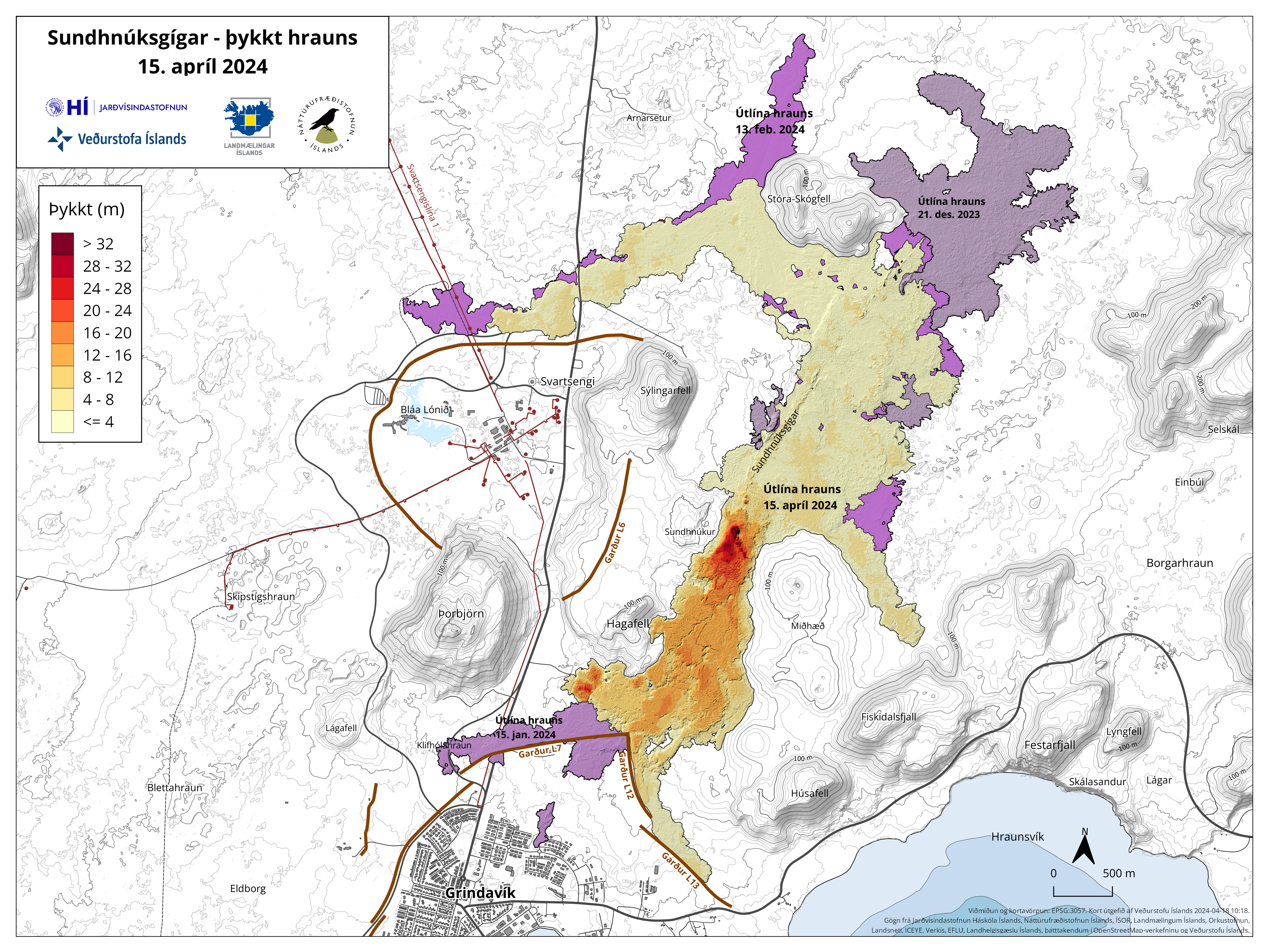 Map showing the lava flow area and the thickness of the lava formed in the ongoing eruption. Purple colors show lava formed in the area since December 2023.
The average lava flow from the crater during the period 8-15 April is estimated at 3.2 ± 0.2 m3/s. This is a small change in relation to the average lava flow during the period 3-8 April, which was estimated at 3.6 ± 0.7 m3/s. The result of previous measurements by the IINH and NLSI photogrammetry team can be seen in the table below.
| From | To | Average lava flow during period (m3/s) | Area (km2) | Volume (million m3) | Average thickness of lava field (m) |
| 16. mar.2024 | 17. mar.2024 | 234 ± 9 | 5,72 | 18,1 ± 0,8 | 3,2 ± 0,1 |
| 17. mar.2024 | 20. mar.2024 | 14,5 ± 0,6 | 5,58 | 20,9 ± 0,5 | 3,7 ± 0,1 |
| 20. mar.2024 | 27. mar.2024 | 7,8 ± 0,7 | 5,99 | 25,7 ± 1,9 | 4,3 ± 0,3 |
| 27. mar.2024 | 3. apr.2024 | 6,6 ± 0,3 | 6,13 | 29,7 ± 1,7 | 4,8 ± 0,3 |
| 3. apr.2024 | 8. apr.2024 | 3,6 ± 0,7 | 6,14 | 31,3 ± 2,4 | 5,1 ± 0,4 |
| 8. apr.2024 | 15. apr.2024 | 3,2 ± 0,2 | 6,15 | 33,2 ± 0,8 | 5,4 ± 0,1 |
Ground uplift in Svartsengi continues at a steady rate. This indicates that about half of the magma ascending from depth is accumulating in the magma reservoir, while the other half erupts to the surface at the Sundhnúkur crater row.
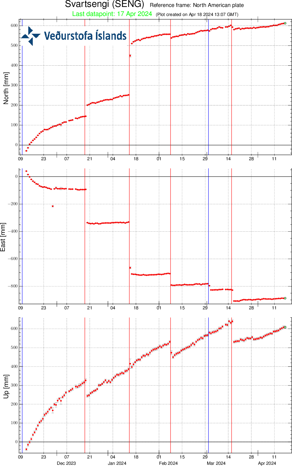 Displacements on the GPS station SENG in Svartsengi since 11 November 2024 to north, east and vertical (top, middle, bottom). The bottom curve shows ground uplift in millimeters, and yesterday‘s (17 April) measurement is shown with a green dot. The red vertical lines are the timing of the last four eruptions (18 December 2023, 14 January, 8 February and 16 March 2024) and the blue lines show the magma dike intrusions that have occurred in the Sundhnúkur crater row area without resulting in an eruption (10 November 2023 and 2 March 2024).
There continues to be a hazard due to gas emissions from the eruption, which can cause pollution in settlements in the Reykjanes Peninsula, and we advise people in the area to monitor air quality and familiarise themselves with the response to air pollution from eruptions.
The weather forecast for gas distribution today (Thursday) is northwesterly wind, 3-8 m/s, carrying gas emissions to the southeast. Tomorrow (Friday) winds will be southeast 8-13 m/s with rain. More southerly winds in the evening. Gas pollution will go to the northwest during the day and later to the north. Follow the gas dispersion forecast here.
- CategoriesEdited | All Content | Disasters | Earthquakes | Volcanos | Government | Science | Europe | Atlantic Ocean | News | News -- WNT Original
- CreatedFriday, April 19, 2024
- Last modifiedMonday, April 22, 2024
SUBSCRIBE
Sign up for our weekly newsletter and World News Trust project updates.

World Desk Activities

www.imf.org/en/News/Podcasts/All-Podcasts/2024/05/…
en.vedur.is/about-imo/news/volcanic-unrest-grindav…

www.sciencealert.com/shift-in-indias-vulture-popul…
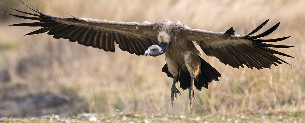
Shift in India's Vulture Population Linked to Half a Million Human Deaths : ScienceAlert
A cattle painkiller introduced in the 1990s led to the unexpected crash of India's vulture populations, which still haven't recovered to their former glory.

Tad author feed item to community feed
Latest Stories


Electronic Frontier Foundation
- Digital Apartheid in Gaza: Unjust Content Moderation at the Request of Israel’s Cyber Unit July 26, 2024
- Electronic Frontier Foundation to Present Annual EFF Awards to Carolina Botero, Connecting Humanity, and 404 Media July 25, 2024
- Briefing: Negotiating States Must Address Human Rights Risks in the Proposed UN Surveillance Treaty July 24, 2024
- Journalists Sue Massachusetts TV Corporation Over Bogus YouTube Takedown Demands July 24, 2024
The Conversation
- Vale Ray Lawler: the playwright who changed the sound of Australian theatre
- Magnificent and humbling: the Paris opening ceremony was a tribute to witnessing superhuman feats of the extraordinary
- How collaboration from across Canada, and the world, is helping fight the Alberta wildfires
- Paris Olympics: Canada’s soccer drone scandal highlights the need for ethics education
The Intercept
- Honduras, 15 Years After the Coup: An Interview With Ousted President Manuel Zelaya July 26, 2024
- Google Planned to Sponsor IDF Conference That Now Denies Google Was Sponsor July 25, 2024
- Deputy Accused of Killing Sonya Massey Was Discharged From Army for Serious Misconduct July 25, 2024
- U.S. Has Never Apologized to Somali Drone Strike Victims — Even When It Admitted to Killing Civilians July 25, 2024
VTDigger
- Waterbury residents looked to FEMA buyouts after last year’s floods. They’ve heard nothing for months July 26, 2024
- At a quiet Craftsbury pond, rowers become Olympians July 26, 2024
- UVM Medical Center wins approval to buy Fanny Allen Campus July 26, 2024
- Landslides and slurries have damaged homes, roads and driveways after this month’s flood July 26, 2024
